Category:Waterfoot, County Antrim
Jump to navigation
Jump to search
village in Northern Ireland .jpg) | |||||
| Upload media | |||||
| Instance of | |||||
|---|---|---|---|---|---|
| Location | Northern Ireland | ||||
 | |||||
English: Waterfoot is a small village in County Antrim, Northern Ireland. It is situated at the foot of Glenariff, one of the Glens of Antrim and has a one-mile (1.5km) beach. It had a population of 504 people in the 2001 Census.
Media in category "Waterfoot, County Antrim"
The following 73 files are in this category, out of 73 total.
-
 Angela's Restaurant, 32 Main Street, Waterfoot - geograph.org.uk - 4133543.jpg 2,048 × 1,360; 919 KB
-
 Antrim hills with sheep - geograph.org.uk - 4814164.jpg 1,506 × 977; 611 KB
-
 Approaching the Red Arch north of Glenariff - geograph.org.uk - 3727835.jpg 1,024 × 768; 120 KB
-
 Arch over the A2 - geograph.org.uk - 5084935.jpg 640 × 480; 502 KB
-
 Bend in the Glenariffe Road - geograph.org.uk - 2586053.jpg 1,024 × 751; 108 KB
-
 Bungalows in Warren Park, Waterfoot - geograph.org.uk - 3711921.jpg 1,024 × 732; 93 KB
-
 Coast at Glenariff - geograph.org.uk - 4813966.jpg 1,611 × 1,118; 553 KB
-
 Crags above Tamlaght - geograph.org.uk - 3886104.jpg 640 × 480; 292 KB
-
 Footbridge over the Glenariff River at Waterfoot - geograph.org.uk - 3711912.jpg 1,024 × 739; 106 KB
-
 Footbridge, Waterfoot - geograph.org.uk - 3886065.jpg 640 × 480; 305 KB
-
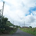
 Garron Road (A2) Waterfoot - geograph.org.uk - 5750763.jpg 640 × 480; 413 KB
-
 Garron Road, Glenariff - geograph.org.uk - 2585996.jpg 1,024 × 605; 122 KB
-
 Garron Road, Waterfoot - geograph.org.uk - 3886083.jpg 640 × 480; 281 KB
-
 Gate off Glenariffe Road - geograph.org.uk - 3886086.jpg 640 × 480; 359 KB
-
 Glenariff - geograph.org.uk - 3886098.jpg 640 × 480; 295 KB
-
 Glenariff or Waterfoot - geograph.org.uk - 459554.jpg 640 × 343; 68 KB
-
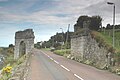
 Glenariff, Red Arch - geograph.org.uk - 5844735.jpg 1,024 × 768; 160 KB
-
 Glenariff, Red Bay Castle - geograph.org.uk - 5844755.jpg 1,024 × 768; 128 KB
-
 Glenariff, Red Bay Pier - geograph.org.uk - 5844741.jpg 1,024 × 768; 117 KB
-
 Glenariffe Road - geograph.org.uk - 3886091.jpg 640 × 480; 332 KB
-
 Glenariffe Road, Waterfoot - geograph.org.uk - 5877376.jpg 1,024 × 768; 416 KB
-
 Glenvale Road, Glenariff - geograph.org.uk - 433601.jpg 640 × 480; 77 KB
-
 House, Waterfoot - geograph.org.uk - 1942274.jpg 640 × 480; 52 KB
-
 House, Waterfoot - geograph.org.uk - 5877374.jpg 1,024 × 768; 367 KB
-
 Information sign at Waterfoot Car Park - geograph.org.uk - 3220575.jpg 4,000 × 3,000; 2.87 MB
-
 Ladder farm in Glenariff - geograph.org.uk - 2583145.jpg 768 × 1,024; 157 KB
-
 Lurigethan from Middle Park Road - geograph.org.uk - 3725243.jpg 1,024 × 767; 111 KB
-
 Lurigethan Promontory from the shores of Red Bay - geograph.org.uk - 2583252.jpg 1,024 × 566; 134 KB
-
 Mariners Bar, Waterfoot - geograph.org.uk - 1942254.jpg 640 × 480; 45 KB
-
 Mural, Waterfoot - geograph.org.uk - 1898158.jpg 640 × 480; 101 KB
-
 New pathway at Waterfoot Beach - geograph.org.uk - 3391361.jpg 1,600 × 1,200; 358 KB
-
 Old harbour building at Red Bay - geograph.org.uk - 3391294.jpg 1,600 × 1,075; 287 KB
-
 On the Antrim Coast Road. - geograph.org.uk - 3291768.jpg 4,320 × 2,432; 6.14 MB
-
 Pier at Red Bay - geograph.org.uk - 5750732.jpg 640 × 480; 526 KB
-
 Public Toilets, Waterfoot - geograph.org.uk - 1898150.jpg 640 × 480; 56 KB
-
 Red Bay slipway - geograph.org.uk - 3391278.jpg 1,600 × 1,200; 547 KB
-
 Rusty bollards at Red Bay Harbour - geograph.org.uk - 3391287.jpg 1,600 × 1,200; 452 KB
-
 Saffron Bar - geograph.org.uk - 3886071.jpg 640 × 480; 257 KB
-

-
 Sign beside the A2 - geograph.org.uk - 3886044.jpg 640 × 480; 287 KB
-
 Stevies, Waterfoot - geograph.org.uk - 1942256.jpg 640 × 480; 52 KB
-
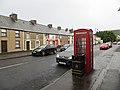 Telephone box, Waterfoot - geograph.org.uk - 3886056.jpg 640 × 480; 255 KB
-
 The "Balmoral" at Red Bay - geograph.org.uk - 3347978.jpg 640 × 412; 71 KB
-
 The beach at Waterfoot - panoramio (1).jpg 3,972 × 1,846; 2.75 MB
-
 The beach at Waterfoot - panoramio.jpg 3,941 × 2,032; 3.07 MB
-
 The end of Red Bay Harbour - geograph.org.uk - 3391313.jpg 1,600 × 1,200; 333 KB
-
 The entrance to the Bay View Estate, Waterfoot - geograph.org.uk - 3711930.jpg 1,024 × 755; 102 KB
-
 The home ground of Oisín Glenariffe CLG - geograph.org.uk - 3711950.jpg 1,024 × 601; 68 KB
-
-
 The lower reaches of Glenariff - geograph.org.uk - 3711940.jpg 1,024 × 740; 85 KB
-

-
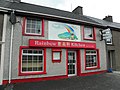 The Rainbow Kitchen, Waterfoot - geograph.org.uk - 1942269.jpg 640 × 480; 60 KB
-
 The Red Arch between Glenariff and Cushendall - geograph.org.uk - 3727847.jpg 1,024 × 767; 122 KB
-
 The ruins of Red Bay Castle - geograph.org.uk - 3727864.jpg 1,024 × 660; 193 KB
-
 The Saffron Bar Waterfoot - geograph.org.uk - 1656382.jpg 640 × 425; 97 KB
-
 View west along Middle Park Road, Cushendall - geograph.org.uk - 3725229.jpg 1,021 × 1,024; 132 KB
-
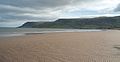
 Waterfoot beach - geograph.org.uk - 1898169.jpg 640 × 480; 54 KB
-
 Waterfoot beach - geograph.org.uk - 1898173.jpg 640 × 480; 51 KB
-
 Waterfoot Beach - geograph.org.uk - 3219428.jpg 1,600 × 1,438; 402 KB
-
 Waterfoot beach - geograph.org.uk - 3219450.jpg 1,600 × 1,200; 270 KB
-
 Waterfoot Beach - HDR (8467543244).jpg 1,800 × 1,200; 1.72 MB
-
 Waterfoot Beach - HDR (8467543362).jpg 1,800 × 1,200; 1.39 MB
-
 Waterfoot Beach - sand patterns - geograph.org.uk - 3219472.jpg 1,200 × 1,600; 359 KB
-
 Waterfoot Beach Car Park - geograph.org.uk - 3220568.jpg 1,600 × 1,373; 281 KB
-
 Waterfoot church seen from the beach - geograph.org.uk - 3219403.jpg 1,600 × 1,200; 514 KB
-
 Waterfoot mural - geograph.org.uk - 1898152.jpg 640 × 480; 82 KB
-
 Waterfoot walled in caves - geograph.org.uk - 3219414.jpg 1,600 × 1,200; 758 KB
-
 Waterfoot White Arch 896.JPG 3,008 × 2,000; 770 KB
-
 Waterfoot White Arch 913.JPG 3,000 × 2,000; 697 KB
-
 Waterfoot White Arch 916.JPG 3,000 × 1,800; 551 KB
-
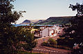 Waterfoot, Co. Antrim, 1990 (6981329372).jpg 2,000 × 1,297; 953 KB
-
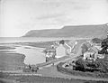 Waterfoot, Co. Antrim, late 19th century (6981346002).jpg 2,000 × 1,528; 786 KB
-
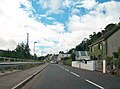
 Waterfoot, Garron Road - geograph.org.uk - 5750761.jpg 640 × 480; 437 KB


_Waterfoot_-_geograph.org.uk_-_5750763.jpg)


.jpg)


.jpg)
.jpg)


.jpg)
